
Status: open
Supervisor: Sebastian Zambanini
Problem Statement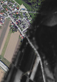
In the DeVisOr project, historical aerial images are registered to modern satellite images for the purpose of geo-referencing. However, feature based registrations only deliver coarse registration that needs to be refined for improved accuracy.
Goal
The goal of this work is to investigate the application of fine registration techniques for aligning historical aerial images with modern satellite images.
Workflow
Literature Review – getting to know the algorithms
Implementation
Evaluation
Written Report/Thesis and final presentation
Literature
[1] Heinrich et al. “MIND: Modality independent neighbourhood descriptor for multi-modal deformable registration” Medical Image Analysis. Vol. 16(7) Oct. 2012, pp. 1423–1435.
[2] Ye, Yuanxin, and Jie Shan. “A local descriptor based registration method for multispectral remote sensing images with non-linear intensity differences.” ISPRS Journal of Photogrammetry and Remote Sensing 90 (2014): 83-95.